Translated by Anette Eklund
“All that shiny area over there is water for irrigation. Water brought by no one. In this place, we sow with water that comes of its own free will”.
Remembrance of Herminio Martínez, about his peasant father.
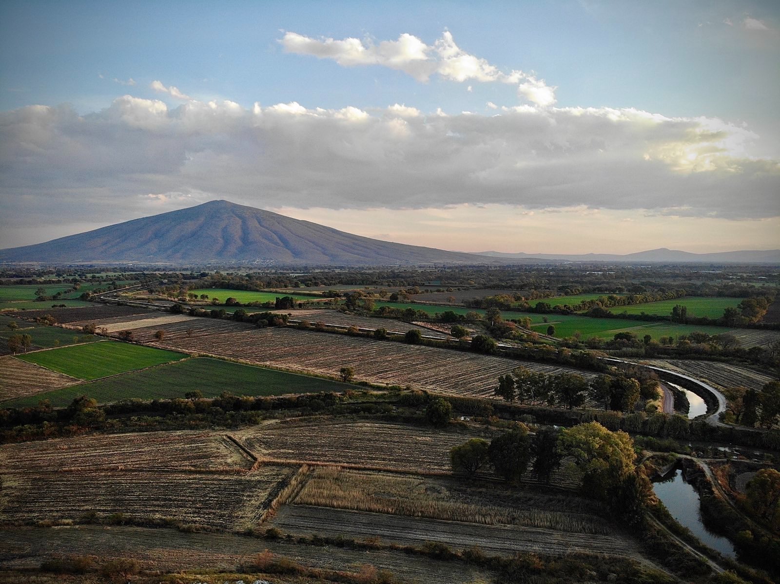
In the state of Guanajuato1 lies The Hill of Culiacán. From its top, it is possible to see the municipalities of Jaral del Progreso, Salvatierra, and Cortazar, the latter where I grew up. To me, The Hill of Culiacán is the most special mountain in the world because it has taught me the importance of enjoying and observing the path, of noticing, for example, slopes, deep ravines, and dense forests before reaching a destination.
“El Culiacán” is considered a sacred mountain, a community protector. In addition, it is the highest altitude hill in central Mexico. With more than 300 antennae standing at its apex, it is responsible for the telecommunications of the whole country in Hertzian codes (which include television, radio, telephone, and data signals).
Every May 3, for hundreds of years, dancers from different backgrounds, summoned by the celebration of Santa Cruz de Culiacán, have climbed to its top. They are usually found in the garden of Cortazar to begin their journey and subsequent ascent from the community of Cañada de Caracheo. It amazes me that the knowledge of Mesoamerican cultures is still present in this community, which nowadays proudly recounts its contribution to the installation and maintenance of the antennas that rise to more than 2,830 meters above sea level, to communicate Mexico with the rest of Latin America in Hertzian code.
In telecommunications, the concept of line of sight refers to the clean, unobstructed path of signals between the transmitting and receiving antennas. The clean transmissions between El Culiacán and the Latinamerican Tower in Mexico City; The Hill of Chiquihuite, also in Mexico City; and The Hill of El Muerto, in Aguascalientes City are good examples.
When I first went to a 3D screen cinema, I felt confused and disoriented since my eyes could not perceive what was designed by engineering. There was a big difference between what I could see and the original projection, even though the distance between the screen and the projector was relatively short. The reason is strabismus, which happens to be a part of me. At the time, the oculists made me notice that “double vision” is not normal; however, this perceptual sensation has been part of my daily life. It was a consequence of having one eye more active than the other.
The feeling is completely different when I remember that El Culiacán has a line of sight with Mexico City because it is almost at the same altitude; due to this reason, the transmission of signals happens without interruptions. Thanks to this memory, I discovered a language that allowed me to imagine the communication within the exchange of waves between lengths and distances. I also understood that all the facts I collected about the territories where I grew up were essential to achieve a certain degree of autonomy in the field of telecommunications, all as part of a language meant to create and build.
I tell you this story because I have the impression that microelectronics and computing within telecommunications have overshadowed territorial knowledge, even when this last one continues to be the backbone of communications in emergency and conflict situations. A clear example is the first seismic detection telematics network. It began its design and development in 1970 and was the same to detect a historical earthquake in Mexico City 15 years later.
This fact changed the international scale of seismic wave compression. It also made visible the relationship earthquakes have with soil characteristics, particularly in lacustrine areas, thanks to the combination of situated knowledge that allowed maintaining a distributed network of seismic recording stations throughout Mexico. Fun fact, they used a line of sight.
Nowadays, the radioelectric spectrum responsible for sending messages has a mercantilist and private orientation in terms of use, access, and distribution. This vision has little to do with the values and objectives of community radios, not to mention that they seem to have forgotten that territoriality has historically made their use possible.
For this reason, Inés Binder and Santiago Garcia Gago propose transferring the defense of the territory and the right to communicate onto the digital and telecommunications spheres because they are historically, culturally, and technologically linked.
For now, when I am in Mexico City and look upon the Hill of Chiquihuite or the Latinamerican Tower, I know that I can see thanks to the line of sight that goes all the way to the most special mountain, despite my limited vision due to strabismus.

1 Guanajuato comes from the Purépecha words kuanasï, which means ‘frog’, and juata, which means ‘hill’, so the word Guanajuato is usually translated as a mountainous place of frogs.